Datoteka:Public Schools Historical Atlas - Roman Britain 400.jpg
Izvor: Hrvatska internetska enciklopedija

Veličina ovog prikaza: 458 × 600 piksela. Ostale razlučivosti: 183 × 240 piksela | 367 × 480 piksela | 880 × 1.152 piksela.
Vidi sliku u punoj veličini ((880 × 1.152 piksela, veličina datoteke: 364 KB, <a href="/wiki/MIME" title="MIME">MIME</a> tip: image/jpeg))
| Ova je datoteka sa stranica Zajedničkog poslužitelja Zaklade Wikimedije i smiju je rabiti drugi projekti. Opis s njezine stranice s opisom datoteke prikazan je ispod. |
Sažetak
| Opis |
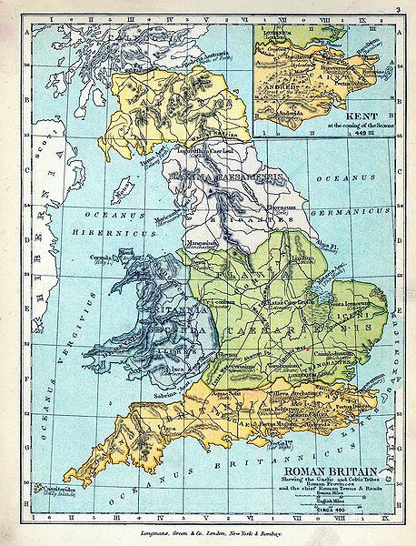
English: Map of Roman Britain in 400. |
| Datum | |
| Izvor |
|
| Autor |
|
| Ostale inačice |
|

Licencija
This media file is in the public domain in the United States. This applies to U.S. works where the copyright has expired, often because its first publication occurred prior to January 1, 1929, and if not then due to lack of notice or renewal. See this page for further explanation.
|
 | |
 |
Povijest datoteke
Kliknite na datum/vrijeme kako biste vidjeli datoteku kakva je tada bila.
| Datum/Vrijeme | Minijatura | Dimenzije | Suradnik | Komentar | |
|---|---|---|---|---|---|
| sadašnja | 18:05, 18. lipnja 2009. | | 880 × 1.152 (364 KB) | Yarl | == {{int:filedesc}} == {{Information |Description={{en|Map of Roman Britain in 400.}} |Source= * ''The Public Schools Historical Atlas'' by Charles Colbeck. Longmans, Green; New York; London; Bombay. 1905. * [http://www.lib.utexas.edu/maps/historical/hist |
Poveznice
Na ovu sliku vode poveznice sa sljedećih stranica: