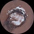
Datoteka:Mars Viking MDIM21 1km plus poles.jpg

Vidi sliku u punoj veličini ((26.674 × 10.670 piksela, veličina datoteke: 46,26 MB, <a href="/wiki/MIME" title="MIME">MIME</a> tip: image/jpeg))
| Ova je datoteka sa stranica Zajedničkog poslužitelja Zaklade Wikimedije i smiju je rabiti drugi projekti. Opis s njezine stranice s opisom datoteke prikazan je ispod. |
| Upozorenje | Izvorna datoteka sadrži veliki broj točkica te je moguće da se neće ispravno učitati ili će uzrokovati smrzavanje preglednika. | Interaktivni preglednik velikih slika |
|---|
Sažetak
| OpisMars Viking MDIM21 1km plus poles.jpg |
English: This global image map of Mars has a resolution of approximately 1.0 km/pixel at the equator. It is a reduced version of a much larger map with 231 m/pixel resolution at the equator. The colorized mosaic was completed by NASA Ames which warped the original Viking colorized mosaic and blended over the latest black/white mosaic. The full resolution mosaic is known as Colorized Mars Digital Image Model (MDIM) 2.1. MDIM 2.1 replaces two earlier mosaics produced by the USGS from the same set of approximately 4600 Viking Orbiter images. The positional accuracy of features in MDIM 2.1 is estimated to be roughly one pixel (200 m), compared to 3 km for MDIM 2.0 released in 2001 and >6 km for MDIM 1.0 released in 1991. In addition to relatively imprecise geodetic control, the previous mosaics were affected by changing definitions of cartographic parameters (such as the definition of zero longitude), resulting in an overall longitude shift of as much as 0.2° between the early MDIMs and other datasets. The new mosaic uses the most recent coordinate system definitions for Mars. These definitions have been widely adopted by NASA missions and other users of planetary data and are likely to remain in use for a decade or more. As a result, MDIM 2.1 not only registers precisely with data from current missions, such as MGS and 2001 Mars Odyssey, but will serve as an accurate basemap on which data from future missions can be plotted. The images used to make MDIM 2.1 were obtained primarily through the red, clear, and minus-blue filters of the Viking Orbiter imaging system, and thus provide a monochromatic view of Mars weighted toward the red end of the visible spectrum. Images were obtained with a wide range of solar incidence angles. It is unfortunately not possible to correct the appearance of both albedo (reflectivity) variations and topographic features for these incidence angle variations simultaneously. The images have therefore been highpass-filtered at a scale of ~50 km to remove regional albedo variations and then normalized so that equal topographic slopes appear with equal contrast everywhere. Photometric processing for MDIM 2.1 incorporates a model of the transmission and scattering of light in the atmosphere that is substantially improved over that used in MDIM 2.0. Residual tonal mismatches between different images after photometric correction were corrected based on a least-squares adjustment of image brightness and contrast. Because of these photometric and cosmetic improvements, it was possible to use a less severe highpass filter than for MDIM 2.0, improving the overall appearance of the mosaic. The original USGS polar mosaics were increased in size by a linear factor of 1.6 and given margins before being appended to the USGS global mosaic. |
| Datum | |
| Izvor | https://astrogeology.usgs.gov/search/details/Mars/Viking/MDIM21/Mars_Viking_MDIM21_ClrMosaic_global_232m/cub |
| Autor | NASA / Jet Propulsion Lab / USGS |
| Ostale inačice |
|
Licencija
| Public domainPublic domainfalsefalse |
This work is in the public domain in the United States because it is a work prepared by an officer or employee of the United States Government as part of that person’s official duties under the terms of Title 17, Chapter 1, Section 105 of the US Code.
Note: This only applies to original works of the Federal Government and not to the work of any individual U.S. state, territory, commonwealth, county, municipality, or any other subdivision. This template also does not apply to postage stamp designs published by the United States Postal Service since 1978. (See § 313.6(C)(1) of Compendium of U.S. Copyright Office Practices). It also does not apply to certain US coins; see The US Mint Terms of Use.
|
 | |
| Ova datoteka je identificirana kao slobodna od poznatih ograničenja po zakonu o autorskim pravima, uključujući sva povezana i srodna prava. | ||
https://creativecommons.org/publicdomain/mark/1.0/PDMCreative Commons Public Domain Mark 1.0falsefalse
Opisi
Predmeti prikazani u ovoj datoteci
motiv
6. ožujka 2014
Povijest datoteke
Kliknite na datum/vrijeme kako biste vidjeli datoteku kakva je tada bila.
| Datum/Vrijeme | Minijatura | Dimenzije | Suradnik | Komentar | |
|---|---|---|---|---|---|
| sadašnja | 06:30, 14. ožujka 2014. | 26.674 × 10.670 (46,26 MB) | WolfmanSF | User created page with UploadWizard |
Poveznice
Na ovu sliku vode poveznice sa sljedećih stranica:
Metapodatci
Ova datoteka sadržava dodatne podatke koje je vjerojatno dodala digitalna kamera ili skener u procesu snimanja odnosno digitalizacije. Ako je datoteka mijenjana, podatci možda nisu u skladu sa stvarnim stanjem.
| Orijentacija kadra | Normalno |
|---|---|
| Vodoravna razlučivost | 72 dpi |
| Okomita razlučivost | 72 dpi |
| Korišteni softver | Adobe Photoshop Elements 9.0 Windows |
| Datum posljednje promjene datoteke | 23:11, 13. ožujka 2014. |
| Kolor prostor | sRGB |
| Važeća širina slike | 26.674 px |
| Važeća visina slike | 10.670 px |
| Datum i vrijeme digitalizacije | 22:27, 13. ožujka 2014. |
| Datum posljednje promjene metapodataka | 16:11, 13. ožujka 2014. |
| Jedinstveni ID izvornog dokumenta | xmp.did:7BFC793B3BABE3118817A2B021119D38 |


