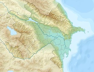
Bozdag
Bozdag | |||||||||||||||||||||||||||||||||||||||||||||||||||||||||||||||||||||||||||||||||||||||||||||||||||||||||||||||||||||||||||||||||||||||||
---|---|---|---|---|---|---|---|---|---|---|---|---|---|---|---|---|---|---|---|---|---|---|---|---|---|---|---|---|---|---|---|---|---|---|---|---|---|---|---|---|---|---|---|---|---|---|---|---|---|---|---|---|---|---|---|---|---|---|---|---|---|---|---|---|---|---|---|---|---|---|---|---|---|---|---|---|---|---|---|---|---|---|---|---|---|---|---|---|---|---|---|---|---|---|---|---|---|---|---|---|---|---|---|---|---|---|---|---|---|---|---|---|---|---|---|---|---|---|---|---|---|---|---|---|---|---|---|---|---|---|---|---|---|---|---|---|---|
{{#if:Pogled na jugoistok Bozdaga i Mingečaursko jezero iz svemira | Pogled na jugoistok Bozdaga i Mingečaursko jezero iz svemira }}
| |||||||||||||||||||||||||||||||||||||||||||||||||||||||||||||||||||||||||||||||||||||||||||||||||||||||||||||||||||||||||||||||||||||||||
Visina | 524,4 m | ||||||||||||||||||||||||||||||||||||||||||||||||||||||||||||||||||||||||||||||||||||||||||||||||||||||||||||||||||||||||||||||||||||||||
Država / pokrajina | Azerbajdžan | ||||||||||||||||||||||||||||||||||||||||||||||||||||||||||||||||||||||||||||||||||||||||||||||||||||||||||||||||||||||||||||||||||||||||
Dio gorja | Veliki Kavkaz | ||||||||||||||||||||||||||||||||||||||||||||||||||||||||||||||||||||||||||||||||||||||||||||||||||||||||||||||||||||||||||||||||||||||||
Koordinate | {{Coord/input/{{#ifeq:N | {{#if:{{#switch:NE|NE|NW|SE|SW=y}}|dms|{{#if:{{#switch:3547|NE|NW|SE|SW=y}}|dm|{{#if:{{#switch:49N|NE|NW|SE|SW=y}}|d|ERROR}}}}}}}}|1=40|2=49|3=35|4=N|5=46|6=47|7=40|8=E|9=|10=|format=|name=}} | |||||||||||||||||||||||||||||||||||||||||||||||||||||||||||||||||||||||||||||||||||||||||||||||||||||||||||||||||||||||||||||||||||||||
Prvi uspon | |||||||||||||||||||||||||||||||||||||||||||||||||||||||||||||||||||||||||||||||||||||||||||||||||||||||||||||||||||||||||||||||||||||||||
Najlakša staza | |||||||||||||||||||||||||||||||||||||||||||||||||||||||||||||||||||||||||||||||||||||||||||||||||||||||||||||||||||||||||||||||||||||||||
Planinarski domovi | |||||||||||||||||||||||||||||||||||||||||||||||||||||||||||||||||||||||||||||||||||||||||||||||||||||||||||||||||||||||||||||||||||||||||
Najbliži gradovi | |||||||||||||||||||||||||||||||||||||||||||||||||||||||||||||||||||||||||||||||||||||||||||||||||||||||||||||||||||||||||||||||||||||||||
Vrsta | |||||||||||||||||||||||||||||||||||||||||||||||||||||||||||||||||||||||||||||||||||||||||||||||||||||||||||||||||||||||||||||||||||||||||
Zadnja erupcija | |||||||||||||||||||||||||||||||||||||||||||||||||||||||||||||||||||||||||||||||||||||||||||||||||||||||||||||||||||||||||||||||||||||||||
Starost | neogen<ref name="rusdva">Юсифов, 1964, с. 23.</ref> | ||||||||||||||||||||||||||||||||||||||||||||||||||||||||||||||||||||||||||||||||||||||||||||||||||||||||||||||||||||||||||||||||||||||||
Ostali vrhovi | |||||||||||||||||||||||||||||||||||||||||||||||||||||||||||||||||||||||||||||||||||||||||||||||||||||||||||||||||||||||||||||||||||||||||
{{#if: |
}} | |||||||||||||||||||||||||||||||||||||||||||||||||||||||||||||||||||||||||||||||||||||||||||||||||||||||||||||||||||||||||||||||||||||||||
none | none | #CCC }};}} margin: 3px;
}} float:{{#switch:right|"center"|center=none|"left"|left=left|"right"|right=right|"none"|none=none|right}}; clear:{{#switch:right|"center"|center=both|"left"|left=left|"right"|right=right|"none"|none=none|right}};{{#if: |
none | none | #CCC}};}}
}} padding: 0px; width: 290px">[[Datoteka:{{#if: Azerbaijan_relief_location_map.jpg | Azerbaijan_relief_location_map.jpg | {{#switch:image |
name=Azerbajdžan | top = 42.0 | bottom = 38.2 | left = 44.5 | right = 51.0 | image = Azerbaijan adm location map.svg | image1 = Azerbaijan relief location map.jpg
}} }}|290px|{{#if:|{{{alt}}}|{{#if:Babadag|Babadag|Bozdag}} na karti {{#switch:name |
name=Azerbajdžan | top = 42.0 | bottom = 38.2 | left = 44.5 | right = 51.0 | image = Azerbaijan adm location map.svg | image1 = Azerbaijan relief location map.jpg
}}}}]] [[Datoteka:{{#if: Red triangle with thick white border.svg
|
Red triangle with thick white border.svg | {{#if: {{#switch:mark | name=Azerbajdžan | top = 42.0 | bottom = 38.2 | left = 44.5 | right = 51.0 | image = Azerbaijan adm location map.svg | image1 = Azerbaijan relief location map.jpg
}}|{{#switch:mark |
name=Azerbajdžan | top = 42.0 | bottom = 38.2 | left = 44.5 | right = 51.0 | image = Azerbaijan adm location map.svg | image1 = Azerbaijan relief location map.jpg
}}|Red pog.svg}} }}|{{#if: 10 |
10x10 | {{#if: {{#switch:marksize | name=Azerbajdžan | top = 42.0 | bottom = 38.2 | left = 44.5 | right = 51.0 | image = Azerbaijan adm location map.svg | image1 = Azerbaijan relief location map.jpg
}}|{{#switch:marksize |
name=Azerbajdžan | top = 42.0 | bottom = 38.2 | left = 44.5 | right = 51.0 | image = Azerbaijan adm location map.svg | image1 = Azerbaijan relief location map.jpg
}}|8}}x{{#if: {{#switch:marksize |
name=Azerbajdžan | top = 42.0 | bottom = 38.2 | left = 44.5 | right = 51.0 | image = Azerbaijan adm location map.svg | image1 = Azerbaijan relief location map.jpg
}}|{{#switch:marksize |
name=Azerbajdžan | top = 42.0 | bottom = 38.2 | left = 44.5 | right = 51.0 | image = Azerbaijan adm location map.svg | image1 = Azerbaijan relief location map.jpg
}}|8}} }}px|{{#if: Babadag |
Babadag | Bozdag }}]]{{#ifeq: | none | Babadag
}} |
<div style="width: {{#expr: 290 + 2 }}px; {{#if: |
none | none | #CCC }};}} margin: 3px;
}} float:{{#switch:right|"center"|center=none|"left"|left=left|"right"|right=right|"none"|none=none|right}}; clear:{{#switch:right|"center"|center=both|"left"|left=left|"right"|right=right|"none"|none=none|right}};{{#if: |
none | none | #CCC}};}}
}} padding: 0px; width: 290px">[[Datoteka:{{#if: Azerbaijan_relief_location_map.jpg | Azerbaijan_relief_location_map.jpg | {{#switch:image |
name=Azerbajdžan | top = 42.0 | bottom = 38.2 | left = 44.5 | right = 51.0 | image = Azerbaijan adm location map.svg | image1 = Azerbaijan relief location map.jpg
}} }}|290px|{{#if:|{{{alt}}}|{{#if:Babadag|Babadag|Bozdag}} na karti {{#switch:name |
name=Azerbajdžan | top = 42.0 | bottom = 38.2 | left = 44.5 | right = 51.0 | image = Azerbaijan adm location map.svg | image1 = Azerbaijan relief location map.jpg
}}}}]] [[Datoteka:{{#if: Red triangle with thick white border.svg
|
Red triangle with thick white border.svg | {{#if: {{#switch:mark | name=Azerbajdžan | top = 42.0 | bottom = 38.2 | left = 44.5 | right = 51.0 | image = Azerbaijan adm location map.svg | image1 = Azerbaijan relief location map.jpg
}}|{{#switch:mark |
name=Azerbajdžan | top = 42.0 | bottom = 38.2 | left = 44.5 | right = 51.0 | image = Azerbaijan adm location map.svg | image1 = Azerbaijan relief location map.jpg
}}|Red pog.svg}} }}|{{#if: 10 |
10x10 | {{#if: {{#switch:marksize | name=Azerbajdžan | top = 42.0 | bottom = 38.2 | left = 44.5 | right = 51.0 | image = Azerbaijan adm location map.svg | image1 = Azerbaijan relief location map.jpg
}}|{{#switch:marksize |
name=Azerbajdžan | top = 42.0 | bottom = 38.2 | left = 44.5 | right = 51.0 | image = Azerbaijan adm location map.svg | image1 = Azerbaijan relief location map.jpg
}}|8}}x{{#if: {{#switch:marksize |
name=Azerbajdžan | top = 42.0 | bottom = 38.2 | left = 44.5 | right = 51.0 | image = Azerbaijan adm location map.svg | image1 = Azerbaijan relief location map.jpg
}}|{{#switch:marksize |
name=Azerbajdžan | top = 42.0 | bottom = 38.2 | left = 44.5 | right = 51.0 | image = Azerbaijan adm location map.svg | image1 = Azerbaijan relief location map.jpg
}}|8}} }}px|{{#if: Babadag |
Babadag | Bozdag }}]]{{#ifeq: | none | Babadag
}} |
Bozdag (azerski: Bozdağ silsiləsi, Qocaşen-Göyçay silsiləsi, ruski: Боздаг) je planinski lanac u Azerbajdžanu. Administrativno pripada Gejgeljskom i Geranbojskom rajonu. Bozdag je četvrti paralelni planinski lanac na južnog padini Velikoga Kavkaza.<ref name="rusjedan">Таривердиев Р. Б.. Заиление Мингечаурского водохранилища. — Б.: Элм, 1974. — С. 11. — 154 с.</ref> Najviši vrh iznosi 524,4 metara.
Etimologija[uredi]
Ime Bozdağ dolazi od azerskog boz (siva) i dağ (planina).<ref>Ахундов А. Об однорядных (чистых) омонимах в топонимии Азербайджана // Советская тюркология. — 1982. — № 1. — С. 36.</ref>
Zemljopis[uredi]
Bozdag se prostire paralelno s Glavnim kavkaskim lancem.<ref name="ruspet">Керимов Ю. Б., Дамиров И. А. Запасы шишкoягод и распространение основных видов можжевельника в Азербайджане // Растительные ресурсы. — 1970. — Т. VI. — С. 436.</ref> Bozdag se prostire od rijeke Gjandžačaj do sela Hanabad (azerski: Xanabad) u Jevlaškome rajonu, tj. oko 60 km. Prije izgradnje Hidroelektrane Mingečaur, rijeka Kura je sjekla Bozdag i izlazila na Kura-Araskoj nizini, pri tome stvarajući na ovome mjestu duboku jarugu koja je u literaturi poznata pod nazivom „Mingečaurski vrat“ (ruski: Мингечаурская горловина).<ref name="rusjedan" /> Većinski se nalazi na desnoj obali rijeke Kure koja siječe istočni dio ovog planinskog lanca. Sjeverni obronci imaju strmine pod kutovima 20 – 60° te su u potpunosti prekriveni smrekom.<ref name="ruspet" /> Bozdag je s tri strane okružen niskom dolinom Širvanske stepe. Na jugu graniči s Mingečaurskim jezerom.<ref name="VSE">Боздаг, Velika sovjetska enciklopedija, pristupljeno 21. prosinca 2019.</ref>
Godine 1958. na padinama Bozdaga organiziran je Turiančajski rezervat.<ref>Чернявская С. И. Турианчайский заповедник // Заповедники Советского Союза. — 1969. — С. 392.</ref>
Geologija[uredi]
U tektonskome pogledu, Bozdag u cjelini predstavlja antiklinalni nabor koji se odnosi na presavijenu zonu, a razvio se u neogenu na sjeveroistočnoj periferiji Malog Kavkaza. U predjelu Bozdaga otkriven je dio koji prekriva sedimente apšeronskog i akčagiljskog sloja.<ref name="rusdva" />
Izvori[uredi]
| references-column-width | references-column-count references-column-count-{{#if:1|{{{1}}}}} }} | {{#if: | references-column-width }} }}" style="{{#if: | {{#iferror: {{#ifexpr: 1 > 1 }} | -moz-column-width: {{#if:1|{{{1}}}}}; -webkit-column-width: {{#if:1|{{{1}}}}}; column-width: {{#if:1|{{{1}}}}}; | -moz-column-count:{{#if:1|{{{1}}}}};-webkit-column-count:{{#if:1|{{{1}}}}};column-count:{{#if:1|{{{1}}}}}; }} | {{#if: | -moz-column-width: {{{colwidth}}}; -webkit-column-width: {{{colwidth}}}; column-width: {{{colwidth}}}; }} }} list-style-type: {{#switch: | upper-alpha | upper-roman | lower-alpha | lower-greek | lower-roman = {{{group}}} | #default = decimal}};"><references group=""></references>
Literatura[uredi]
- Юсифов Р. Ю.. Перспективы нефтегазоносности третичных отложений в пределах хребта Боздаг // Известия Академии наук Азербайджанской ССР. — 1964.